The New Standard for Seeing a Site Clearly
Every successful project begins with clear information. When teams are forced to rely on incomplete photos, rushed walkthroughs, or secondhand updates, small mistakes become big delays. That is why drone-based inspections and mapping are becoming a standard tool for modern jobsite management. Aerial data gives decision-makers a wider perspective, helping them understand what is happening across a full property, site, or asset without losing time. Instead of guessing where the problem is or hoping the conditions are stable, teams can review accurate visuals and measurements that support real planning. The value is not just in the flight itself, but in the clean data that helps teams move forward with confidence and control.
Construction Site Mapping That Keeps Projects Moving
Construction is one of the fastest-moving environments in any industry, and progress can change from morning to evening. Drone mapping supports better scheduling and communication by capturing consistent views of the jobsite that teams can review and compare over time. When Drone surveying for construction project work is done correctly, it becomes a powerful tool for tracking progress, confirming site conditions, and keeping contractors aligned. It reduces confusion between trades, improves planning meetings, and supports stronger documentation for stakeholders. Instead of relying on scattered photos or incomplete notes, aerial mapping provides a full view that makes it easier to spot issues early, confirm work completed, and plan what comes next without wasting valuable hours.
Utility and Infrastructure Work That Demands Safety
Utilities and infrastructure projects often involve complex sites where safety must remain a priority. Some locations are difficult to access, and traditional inspection methods can increase risk, especially when crews need to climb, enter restricted areas, or work around active operations. Drone inspections provide a safer alternative by capturing detailed information without unnecessary exposure. Terranova Drones LLC focuses on delivering reliable aerial data that supports better analysis and faster decision-making while keeping safety at the center of the process. By using structured planning, responsible flying, and professional reporting, utility teams can reduce downtime, improve awareness, and make smarter decisions with fewer disruptions to operations.
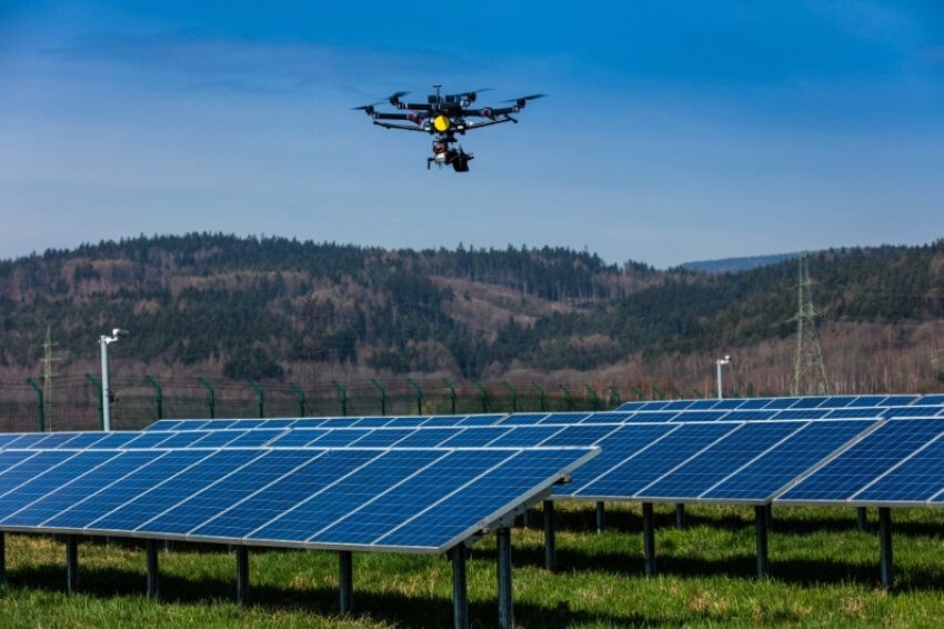
Solar Inspections That Identify Problems Faster
Solar arrays are designed for long-term performance, but even small faults can impact output and efficiency. The challenge is that many solar issues are not visible from the ground, and manual inspections can take too long when time matters. Drone inspections provide a faster way to scan large solar fields and pinpoint areas that need attention. For companies that require Aerial solar array inspections in U.S, drone data supports quicker troubleshooting and more confident maintenance decisions. Terranova Drones LLC brings over a decade of electrical and solar experience, which means inspections are guided by real-world understanding of how solar systems work, where issues typically appear, and what details matter most for repairs and performance improvements.
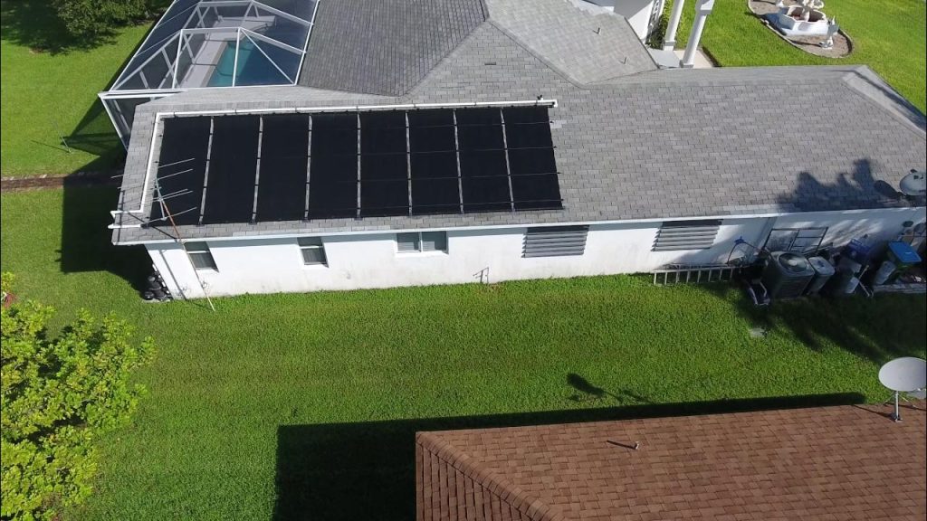
Roof Inspections That Support Better Documentation
Roof inspections are often needed for maintenance planning, repair decisions, and asset documentation. Traditional inspections can be time-consuming and may require ladders, safety equipment, and additional labor. Drone roof inspections provide a safer, faster alternative while delivering clear visuals that support accurate assessment. Whether a roof is being evaluated for wear, storm damage, or preventative maintenance, drone imagery makes it easier to document key areas and communicate findings. For projects needing Drone roof surveying solutions in U.S, Terranova Drones LLC provides a professional process that prioritizes safety, efficiency, and clear deliverables. The result is data that helps clients make confident decisions without unnecessary delays or risk.
What Clients Gain From Fast and Accurate Aerial Data
The strongest advantage of drone services is the ability to deliver fast, accurate data that clients can actually use. Aerial mapping and inspections improve communication, reduce guesswork, and support faster decision-making across multiple industries. Terranova Drones LLC is built on transparency, honesty, and hard-working ethics, which means every project is handled with professionalism and clear expectations. The goal is to support productivity and safety while providing results that help clients complete their end goals efficiently. As the company expands across U.S and into additional states, the focus remains the same: deliver reliable data, maintain strong customer relationships, and provide drone solutions that make real work easier, safer, and more effective.